¿Ha perdido la contraseña?
¿Nuevo usuario? Crear una cuenta
Lizard fish, Philippines. Photo by Stephane Rochon.
¡Disfrute y contribuya!
| Encontrar los mejores sitios |
|
|
 Cook Islands
Australia y el Pacífico
Ubicación: Oceania, group of islands in the South Pacific Ocean, about one-half of the way from Hawaii to New Zealand
Coordenadas geográficas: 21° 14' S, 159° 46' W
Km de línea costera: 120 km km
Clima: tropical oceanic; moderated by trade winds; a dry season from April to November and a more humid season from December to March
Terreno: low coral atolls in north; volcanic, hilly islands in south
Cumbres: lowest point: Pacific Ocean 0 m
highest point: Te Manga 652 m
Riesgos naturales: typhoons (November to March)
Moneda: NZ dollar (NZD)
Población: 21,750 (July 2007 est.)
Lenguas: English (official), Maori
Capital: Avarua
División administrativa:
Más detalles
| Jan | Feb | Mar | Apr | May | Jun | Jul | Aug | Sep | Oct | Nov | Dec | |
|---|---|---|---|---|---|---|---|---|---|---|---|---|
| Climate | ||||||||||||
| Air temp. | ||||||||||||
| Water temp. | ||||||||||||
| Equipment | Don't know | Don't know | Don't know | Don't know | Don't know | Don't know | Don't know | Don't know | Don't know | Don't know | Don't know | Don't know |
| Best season | ||||||||||||
Mapa adicional
¿Quiere añadir más informacion sobre Cook Islands? Háganos saber...
¡Este es un mapa interactivo! Use los controles para recorrerlo y hacer zoom.
- Favoritos
-
Sus listas de sitios de buceo favoritos
¿Su zona favorita no está en la lista? Añadir una zona
Zonas
| Zonas (2) | Sitios de buceo | Sub-zonas |
|---|---|---|
| Aitutaki | 1 | 0 |
| Rarotonga | 4 | 0 |
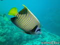
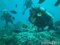
 Fotos
Fotos
Aruntanga Passage |
Aruntanga Passage |
Aruntanga Passage |
Alberto s |
Comentarios
Errores, opiniones.
Si quiere añadir nueva información o si ha encontrado errores en esta país, Envíe sus observaciones