¿Ha perdido la contraseña?
¿Nuevo usuario? Crear una cuenta
Big eye, Philippines. Photo by Stephane Rochon.
¡Disfrute y contribuya!
| Encontrar los mejores sitios |
|
|
 Federal State of Micronesia
Australia y el Pacífico
Ubicación: Oceania, island group in the North Pacific Ocean, about three-quarters of the way from Hawaii to Indonesia.
Coordenadas geográficas: 6° 33' N, 158° 9' E
Km de línea costera: 6,112 km km
Clima: tropical; heavy year-round rainfall, especially in the eastern islands; located on southern edge of the typhoon belt with occasionally severe damage
Terreno: islands vary geologically from high mountainous islands to low, coral atolls; volcanic outcroppings on Pohnpei, Kosrae, and Chuuk
Cumbres: highest point: Dolohmwar (Totolom) 791 m
Riesgos naturales: typhoons (June to December)
Moneda: US dollar (USD)
Población: 108,105 (July 2005 est.)
Lenguas: English (official and common language), Trukese, Pohnpeian, Yapese, Kosrean, Ulithian, Woleaian, Nukuoro, Kapingamarangi
Capital: Palikir
División administrativa: 4 states; Chuuk (Truk), Kosrae (Kosaie), Pohnpei (Ponape), Yap
Más detalles
| Jan | Feb | Mar | Apr | May | Jun | Jul | Aug | Sep | Oct | Nov | Dec | |
|---|---|---|---|---|---|---|---|---|---|---|---|---|
| Climate | ||||||||||||
| Air temp. | ||||||||||||
| Water temp. | ||||||||||||
| Equipment | ||||||||||||
| Best season | ||||||||||||
Mapa adicional
¿Quiere añadir más informacion sobre Federal State of Micronesia? Háganos saber...
¡Este es un mapa interactivo! Use los controles para recorrerlo y hacer zoom.
- Favoritos
-
Sus listas de sitios de buceo favoritos
¿Su zona favorita no está en la lista? Añadir una zona
Zonas
| Zonas (5) | Sitios de buceo | Sub-zonas |
|---|---|---|
| Guam | 7 | 0 |
| Kosrae | 1 | 0 |
| Pohnpei | 10 | 0 |
| Truk Lagoon | 16 | 0 |
| Yap | 20 | 0 |
Sitios de buceo
| Sitios de buceo (2) | Calidad | Profundidad media | Profundidad máxima | Experiencia | Tipo de buceo | ||
|---|---|---|---|---|---|---|---|
| Lelu Aeroplane | - / - | 20 m | 35 m | CMAS * / OW | 

|
||
| Lelu Wrecks | - / - | 18 m | 30 m | CMAS * / OW |
|
 Fotos
Fotos
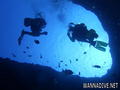
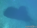
Blue hole |
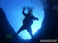
Blue hole |
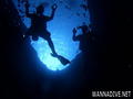
Blue hole |
Blue hole |
Últimos logs de buceo
|
Comentarios
Errores, opiniones.
Si quiere añadir nueva información o si ha encontrado errores en esta país, Envíe sus observaciones